The Mercator is a propaganda campaign to make Christian countries look big and powerful. Ask yourself why is it only “Christian” countries that are distorted.
Navigation isn’t the only purpose of maps. You can display geographical, social, economic, and a whole host of other datasets on to maps. And since maps with fidelity to lat/long lines are no longer a requirement for navigation, there’s a good argument for accurately displaying relative positioning and size.
When was the last time you used a global map for navigation?
It’s not even terribly good for that, as when traveling at global scales, most of us travel along great circle paths that end up looking wrong on the Mercator protection.

The Mercator is a propaganda campaign to make Christian countries look big and powerful. Ask yourself why is it only “Christian” countries that are distorted.
Edit: should have put this /s
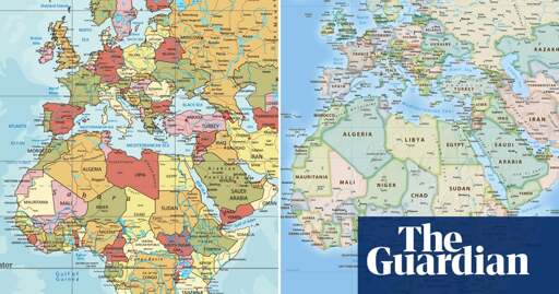
The Mercator projection is good in what it was made for: Navigation. You know. The whole purpose of maps.
Navigation isn’t the only purpose of maps. You can display geographical, social, economic, and a whole host of other datasets on to maps. And since maps with fidelity to lat/long lines are no longer a requirement for navigation, there’s a good argument for accurately displaying relative positioning and size.
When was the last time you used a global map for navigation?
It’s not even terribly good for that, as when traveling at global scales, most of us travel along great circle paths that end up looking wrong on the Mercator protection.
I know right! It’s all done to further Antarctica’s hegemony! Just look how huge it seems!
/uj If you want no distortions, get a globe.
But what about Latin America and Christians parts of Africa
Those are inferior skin colors so they’re excluded.
I added to the original comment but I’m trolling lol